Latest posts


What you need to know about Kenya’s Agro-Ecological Zones (AEZs)
By Agcenture | Published | No Comments
Have you ever wondered why some crops like coffee thrive in certain areas while fail in others? The secret is Agro-Ecological Zones (AEZs). An AEZ is a unique geographic area that have similar climatic and soil condition. These determine the type of crops or livestock that you can grow in that area. In this post, we will show you how you can use the AEZ knowledge to increase your crop yields, reduce production costs, and manage your land and resources in a more sustainable way.
Why You Should Care About Agro-Ecological Zones?
There are many benefits of understanding your AEZ in your goals to increase your yields and profits. As a decision making and planning tool, you can know which crops to grow, when to plant them, and how to protect them from pests cheaply. Below are simple ways that you can transform farming in Kenya using farming zones information;
- 🔍Crop Selection: Grow the best crop varieties for to your region’s climate, soil, and altitude. In seed selection, AEZ will influence factors such as heat tolerance, water requirements, disease resistance, and market demand.
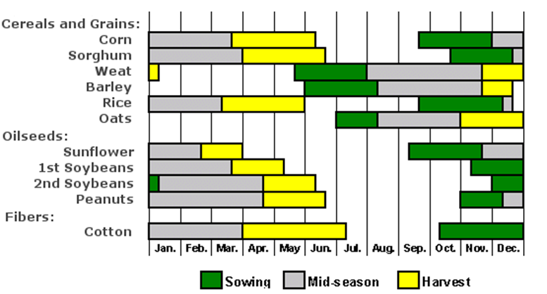
- 📅Planting Calendar: use your AEZ information to make and use a crop calendar. It wiill help you to plan planting and harvesting dates, growing season, timing of rainfall and irrigation etc. This way you can increase your harvests potential by aligning with periods of optimal conditions.
- 💧Irrigation Strategies: Based on your AEZ’s rainfall patterns and water availability, determine the most suitable water management for your farm. This will prevent water stress, optimize crop growth, and conserve this precious resource. Irrigation techniques include drip irrigation, furrow irrigation, and sprinkler systems.
- 🌱Soil Management: Adapt your soil management practices such as soil testing, use of agriculture lime, organic matter, erosion control measures etc, to the specific characteristics of your AEZ’s soils features. This may involve soil testing and analysis to understand your nutrient requirements and necessary pH adjustments.
- 🐛Pest and Disease Control: By understanding the common pests and disease in your region, you can effectively protect your crops and minimize the need for excessive pesticide use. You can then implement integrated pest management (IPM) strategies that prioritize prevention, monitoring, and biological control methods.
- 🌦️Climate Resilience: With the knowledge of your AEZ’s climatic conditions, explore climate-resilient farming practices. This may include incorporating agroforestry, cover cropping, or mulching to improve soil moisture retention, regulate temperature, and enhance overall ecosystem health. Diversifying your crop portfolio can also increase resilience against unpredictable weather patterns.
What are Agro-Ecological Zones?
Agro-Ecological Zones (AEZs) are a classification system that categorizes different regions based on their unique combinations of climate, soil characteristics, and topography. Let us see how each of this are likely to affect your farming activities.
- Climate: AEZs take into account climate factors such as temperature, rainfall patterns, and length of growing seasons. Some regions like around Lake Victoria have consistent rainfall throughout the year. Other areas such as highlands have distinct wet and dry seasons. The climate variations in your AEZ will determine its suitable crops and planting seasons.
- Soil Types: Different AEZs have varying soil types, like sandy, loamy, clayey, or volcanic soils. Soil composition affects water retention, nutrient availability, and drainage capabilities. Understanding your AEZ’s soil characteristics will inform your soil management practices, fertilization, irrigation, and crop rotation.
- Topography and Altitude: AEZs consider the topographical features and altitude in metres above sea level of an area. Sloping terrains, highlands, or lowland plains within an AEZ can impact factors like water runoff, erosion risk, and temperature variations. This knowledge helps you to grow the appropriate crops suitable for the elevation of your AEZ.
- Biodiversity and Ecological Features: AEZs also take into account the natural biodiversity and ecological features of an area. This includes the presence of rivers, lakes, forests, or other ecological zones that contribute to the local ecosystem. Such features may influence microclimates, insect populations, or the availability of pollinators, impacting crop selection and pest management strategies.
How Can you identify your Agro-Ecological Zones?
We have seen how AEZ will affect your farming activities, profits and yields. But how do you know your region’s specific AEZ? Below are five simple ways you can know this.
Use Agro-Ecological Zone Maps: agro-climatic maps categorize regions based on climate, soil types, and topography, providing an overview of different AEZs within your country or region. Locate your farm on the map to identify your general AEZ classification.
Gather Local Climate Data: Collect historical data on local climate parameters such as average annual rainfall, temperature ranges, and growing season length. This information is often available from meteorological stations or agricultural extension offices.
Analyze Soil Characteristics: Conduct soil tests to determine the soil type, pH levels, and nutrient content of your farm. Soil testing kits and services are typically available through agricultural extension offices or private laboratories.
Consider Topographical Factors Assess the topography and elevation of your farm. Determine if your farm is located in highland areas, lowland plains, or hilly terrains. Topographical features influence factors such as water drainage, temperature variations, and exposure to winds.
Consult Local Knowledge and Expertise: Engage with local agricultural experts, agronomists, or experienced farmers in your area. They possess valuable insights and firsthand knowledge about the AEZs specific to your region.
Agro-Ecological Zones maps in Kenya
Use of agro-climatic maps is one of the most reliable methods that you can use, you can use harcopies or online maps and apps to determing your areas AEZ. Below we will give you 3 commonly used AEZ maps commonly used in kenya for your perusal. These maps are; the FAO AEZ System, the Kenya AEZ System, and the ASTGS AEZ system.
ASTGS AEZs System
Its it a 2019 classification system. Kenya is divided into seven distinct agro- ecological zones based on soil type and rainfall. See the table and map below for details.
| AEZ | Households | Rainfall | Farm Size | Income (KES/month) |
|---|---|---|---|---|
| Western | 1.6m | 1,200-1,800mm | 0.5-5 acres | 15,000 |
| Rift Valley | 0.4m | 600-1,200mm, | 2-60 acres | 30,000 |
| Central Highlands | 1.0m | 1,600->2,000mm | 2-5 acres | 30,000 |
| Semi Arid Uplands | 0.5m | 600-1,200mm, | 2-5 acres | 15,000 |
| North ASALS | 0.4m | <200-600mm | Group ranches | <10,000 |
| Central ASALS | 0.3m | 400-800mm | Group ranches | <10,000 |
| Coast | 0.3m | 600-1,200mm | 1-10 acres | <10,000 |
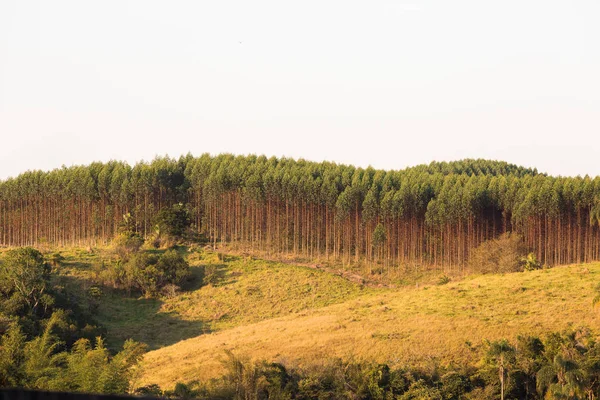
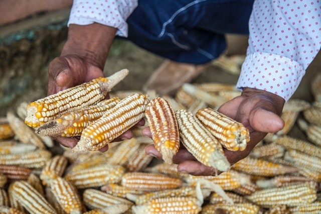
- Western: moderate to deep red soils of medium-high fertility and two seasons of medium rains of 2 seasons, long season in March, short season in November. suitable for mixed staples and cash crops including maize, French beans, sugar cane, groundnuts, sweet potatoes, Irish potatoes, dairy, poultry and a variety of fish species.
- Rift Valley: mixed shallow/low with deep/highly fertile soils and one season of moderate rainfall, 1 season in March suitable
for mixed staples, cash crops and livestock including maize, wheat, sorghum, Irish potatoes, honey, goats, sheep, chicken and dairy cattle - Central highlands: deep red highly fertile soils, two seasons of high rainfall, 2 seasons, March & Nov. suitable for cash crops including coffee, tea, Irish potatoes, French beans, bananas, tomatoes and other staples including dairy cattle and poultry
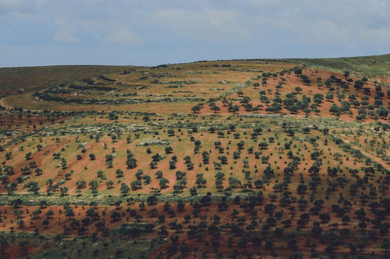
- Semi-arid uplands: red, acidic, low to moderately fertile soils, with one season, in Novembe of low rains suitable for dryland crops such as sorghum and pigeon peas, and beef cattle
- Northern ASALs: sandy, saline, shallow, low-fertility soil with one season of rain at best, suitable for livestock pastoralism including camels, goats and sheep, with occasional maize cultivation on raised plateaus
- Central ASALs saline, low-fertility soils, with one season of rain at best, suitable for livestock pastoralism including beef cattle, goats and sheep, with occasional maize cultivation on raised plateaus
- Coast: mix of sandy, deep, low and highly fertile soil and two seasons of moderate rainfall suitable for mixed staples and cash crops including maize, sorghum, millet, cashew nuts, mangoes, marine fish, crustaceans and molluscs and livestock such as poultry
FAO AEZs System
This simple agro-ecological zones were established by FAO in 1981. It uses temperature belts to classify kenya farming zones into lowlands, lower midlands, midlands, lower highlands, upper highlands and high alitude areas. Using this classification, Kenya has following AEZs.
- AEZ 0 corresponds to ever wet evergreen rainforest
- AEZ 1 to evergreen rainforest
- AEZ 2 to seasonal rainforest because of one or two dry months
- AEZ 3 has three to five dry months, it corresponds to seasonal semi-deciduous moist forest or a high grass – broad leaved trees savanna
- AEZ 4 corresponds to woodland, it is either deciduous in subzone with unimodal rainfall as towards West Kenya and in Tanzania, or hard-leaved evergreen in bimodal rainfall subzones with two dry seasons as in East Kenya, where plants have hard or hairy leaves to avoid shedding them off twice a year. The grass is up to 1 m high.
- AEZ 5 – the natural vegetation in is a short grass savannah with small leafed thorny trees and bushes.
- AEZ 6 is bush land with very short but still perennial grass, therefore it is suitable for ranching – if the grass (the standing hay for the dry season) is not eradicated by overgrazing.
- AEZ 7 indicates Semi-desert
- AEZ 8 full desert
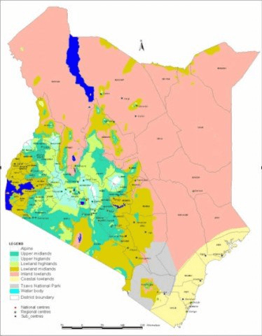
Kenya AEZs System
Using the Kenya system, there are 5 AEZs. They are shown in the table and diagram below. The important zones for agriculture are zones II,III, IV andV for rain fed crop farming
| Zone | Area (km2) | % Total | Rainfall (mm) |
|---|---|---|---|
| I. Agro-Alphine | 800 | 0.1 | |
| II. High Potential | 53,000 | 9.3 | 1000 < |
| III. Medium Potential | 53,000 | 9.3 | 950-1500 |
| IV. Semi-Arid | 48,200 | 8.5 | 500-1000 |
| V. Arid | 300,000 | 52.9 | 300-600 |
| VI. Very arid | 112,000 | 19.8 | 200-400 |
| Rest (waters etc) | 15,600 | 2.6 |
- Zone I Agro-Alpine; It is confined to mountains and immediate surrounding such as Mt. Kenya and Mt Elgon.
- Zone II High Potential; Restricted to the highlands of Kenya between 1980 and 2700 metres above seal level (MASL). The minimum rainfall is 1000 mm. It is found around Mt Kenya (parts of Meru, Embu, Kirinyaga and Nyeri), Mau and Aberdares mountains (e.g around Kericho and Nyahururu and the surrounding of Mt Elgon (e.g around Kitale and Webuye).
- Zone III Medium Potential; This zone occurs mainly at elevations between 900-1800 m with annual rainfall between 950 and 1500 mm. It is the most significant for agricultural cultivation. It occurs in the vast parts of Nyanza, Western and Central provinces, good proportion of Central Rift-Valley (Nandi, Nakuru, Bomet, Eldoret, Kitale) and a small strip at the Coast province.
- Zone IV; Semi Arid; The zone occupies the same elevation (900-1800 m).However, it has lower rainfall of about 500-1000 mm. Examples are Naivasha, vast parts of Laikipia and Machakos districts vast parts of central and southern Coast Province.
- Zone V; It occurs at lower elevations. Annual rainfall is 300-600. This Zone is prevalent in northern Baringo, Turkana, lower Makueni and vast parts of North Eastern Province.
- Zone VI: This is the semi desert and is the driest part of Kenya. Annual rainfall is 200-400 mm and is quite unreliable. The zone is found in Marsabit, Turkana, Mandera and Wajir counties.
- Zone VII; This is represented by Chalbi desert in Marsabit district. The Chalbi is a salt desert with very sparse salt bushes as the only vegetation found.
By understanding your Agro-Ecological Zone, you gain a competitive edge in the farming world. Embrace the power of AEZ knowledge and witness the transformation of your agricultural endeavors. Embrace the diversity of Kenya’s farming landscapes, adapt your practices accordingly, and reap the rewards of sustainable and thriving farming ventures.
Did you Like the Post? Let us know below
Agcenture.com is your best agriculture, food & health blog.
Thank you for following us on Facebook, Twitter (X), LinkedIn, YouTube, and WhatsApp @ Agcenture for the latest updates.
Leave a Reply